Baldwin Hill Conservation Area
Location
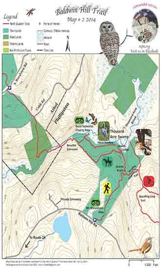
Map Legend

Icons on the map can be clicked to get directions on Google Maps (works best for Parking Icons).
Get the Map
This property is in NQTA Map #2. You can purchase NQTA Map Sets in our Shop.
Directions
The Baldwin Hill Trail is accessible from RTE 2A at the RTE 2 Interchange. From RTE 2 West: Take Exit 18 on the Athol/Phillipston Town line, take a left off the exit and proceed for 0.3 miles. Baldwin Hill Road will be the first road on the right. Follow Baldwin Hill Road for 0.8 miles to the trailhead, parking on the left hand side of the road.
From RTE 2 East: Take Exit 18 on the Athol/Phillipston Town line, take a left off the exit and proceed for 0.5 miles. Baldwin Hill Road will be the first road on the right. Follow Baldwin Hill Road for 0.8 miles to the trailhead, parking on left hand side of the road.
Overview
Please be respectful of private property and stay on the marked trail.
Photo Gallery
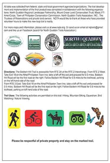
Activities
Bird Watching, Equestrian, Hiking, Nature ViewingAdditional Information
The trail development and implementation of the final product was completed in collaboration with the following organizations: North Quabbin Regional Landscape Partnership, Mount Grace Land Conservation Trust, MassLIFT- AmeriCorps, Town of Phillipston Conservation Commission, North Quabbin Trails Association, Inc., The Trustees of Reservations and private land owners. NQTA would like to thank all those who have provided volunteer hours to make this new loop trail a reality.