Bearsden 2 Shelter Hike
Location
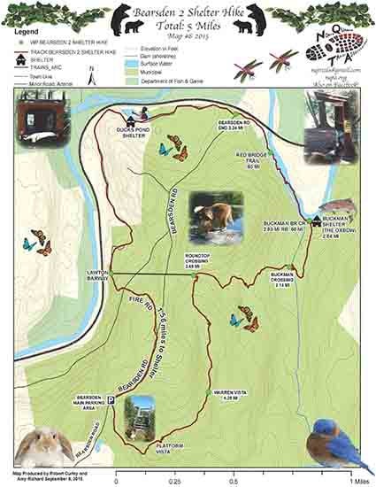
Map Legend

Icons on the map can be clicked to get directions on Google Maps (works best for Parking Icons).
Get the Map
This property is in NQTA Map #7. You can purchase NQTA Map Sets in our Shop.
Directions
FROM RTE 2 WEST: Take exit 18 for MA 2A toward Athol, Follow MA-2A W to Bearsden Rd
(8 min (3.3 mi), Take sharp right on Bearsden Rd.
FROM RTE 2 EAST: Take exit 19 for MA 2A/U.S. 202 N toward Phillipston / Winchendon 0.3 mi, Turn left onto MA-2A W (signs for MA 2A W/Phillipston) 4.5 mi, Take a sharp right onto Bearsden Rd.
The Bearsden 5 Mile 2 Shelter walk starts at the main parking lot at Bearsden.
Follow Bearsden Rd and take a left onto “Fire Rd”. Follow Fire Rd 1.56 miles down to the Millers River, along Millers River to Duck Pond Shelter.
Follow along Duck Pond Shelter back to the Millers to the Red Bridge Trail.
Follow the picturesque Red Bridge Trail over to Buckman Shelter.
Follow up to Buckman Crossing, take Round Top Trail, up to top of Round Top with fire tower, and then down Round Top to Main Parking Lot. This completes the Bearsden 2 Shelter 5 Mile Hike.
These 2 shelters in the Bearsden Conservation Area are free for usage.
Please call 978-249-2004 ahead for permit.
Overview
Please be respectful of private property and stay on the marked trail.
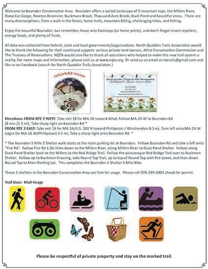
Welcome to Bearsden Conservation Area. Bearsden offers a varied landscape of 5 mountain tops, the Millers River, Deep Cut Gorge, Newton Reservior, Buckmans Brook, Thousand Acre Brook, Duck Pond and beautiful vistas. There are many diverseoptions, from a walk in the forest, horse trails, mountain biking, challenging hikes, and fishing.
Enjoy the beautiful Bearsden, but remember, leave only footsteps (or horse prints), and don’t forget insect repellent, energy foods, and plenty of fluids.
Photo Gallery
Activities
Hiking, Nature ViewingAdditional Information
All data was collected from federal, state and local governments/organizations.
North Quabbin Trails Association would like to thank the following for their continued support: various private land owners, Athol Conservation Commission and The Trustees of Reservations. NQTA would also like to thank all volunteers who helped to make this new trail system a reality.